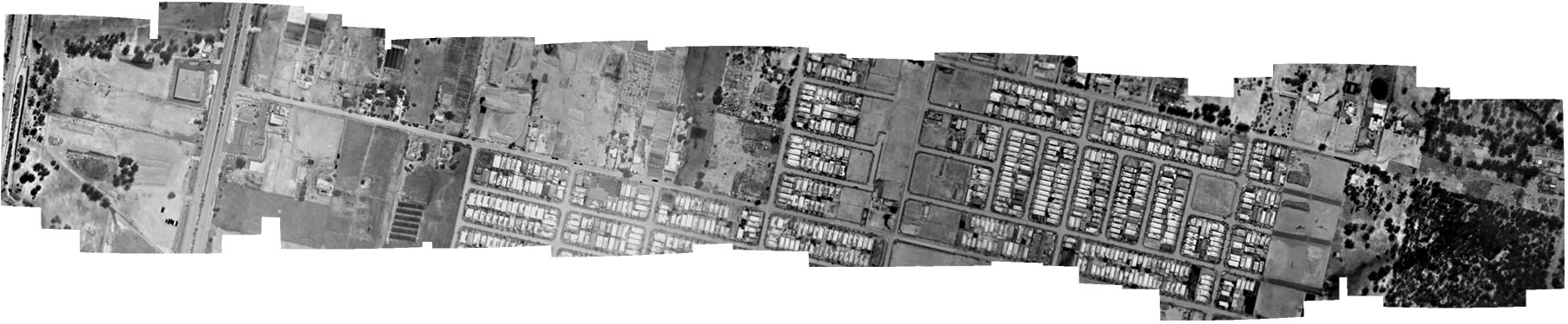
Mapping temperature at scale
Spatial Scientific Pty Ltd specialises in airborne thermal imaging from manned aircraft across Australia. Using advanced thermal sensors mounted to crewed platforms, we can map large areas quickly and operate in places where drones often can't (especially over towns and cities). The result is georeferenced thermal imagery that can be correlated directly with temperature, producing accurate, GIS-ready heat maps. We've been delivering airborne thermal projects for over a decade, supplying thermal mapping products to dozens of companies and government organisations.
Thermal imaging supports a wide range of applications, including spontaneous combustion and underground fire mapping (mining), urban heat island mapping, environmental monitoring and vegetation health assessment, feral animal surveys, bushfire mapping and management, and mineral exploration.
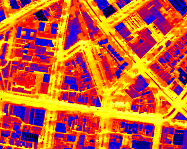
Urban heat island mapping
Urban heat island mapping with airborne thermal imaging involves measuring the thermal radiance (heat emitted) from ground surfaces and converting it into georeferenced temperature-indicative layers across an urban area; capturing patterns over buildings, roads, vegetation, waterways, and other landcover types. The thermal sensor is mounted on a manned aircraft, which makes it practical to survey large areas (e.g., whole suburbs or LGAs) and also operate over places where drones are typically restricted (towns/cities). Data can be acquired by day, by night, or both, enabling analysis of diurnal cooling behaviour (i.e., which neighbourhoods retain heat overnight versus cool rapidly), and those differences can then be correlated with landcover to understand drivers of heat and potential mitigation options. The resulting thermal imagery can be aligned to existing orthophotography to achieve better than ~2 m positional accuracy, and outputs can be delivered as GIS-ready datasets (and/or interpreted summaries and reports) so the results are usable even without deep GIS expertise.
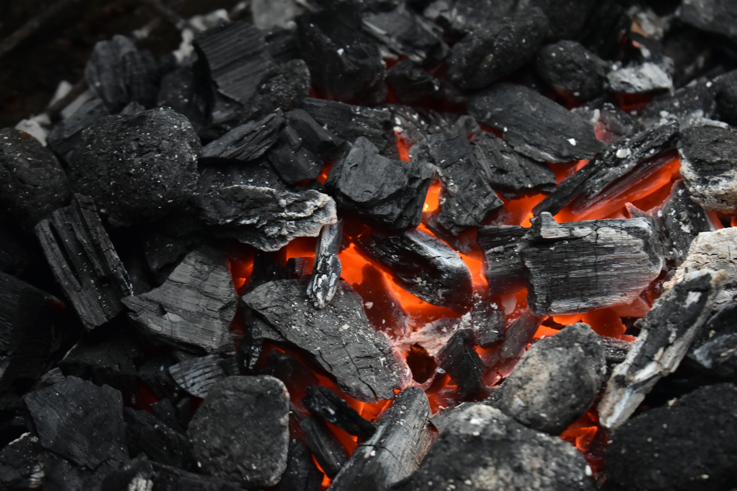
Spontaneous combustion detection
Spontaneous combustion in organic stockpiles and waste streams is usually preceded by a period of low‑level self‑heating. Radiometric airborne thermal imaging lets us measure that heating over large areas, find emerging hotspots early, and map their exact position so ground crews can respond safely.
We fly repeatable survey lines and convert the raw thermal data into georeferenced temperature layers and hotspot polygons. Outputs can be delivered as ortho‑mosaics, GIS layers, and simple site maps with temperature statistics (peak, mean, area above threshold) for each hotspot.
Typical applications include hay and straw stacks, compost and green‑waste facilities, grain and biomass storage, landfill cells, coal and sulphide-bearing waste, and industrial sites where overheating can develop out of sight. If required, we can design a monitoring cadence (e.g. weekly, after rain events, after re‑handling) to build a time‑series that separates benign diurnal warming from genuine thermal anomalies.
About Spatial Scientific
Spatial Scientific Pty Ltd builds airborne mapping systems, acquires data from crewed aircraft, and produces georeferenced datasets and maps for operational use. Our core capability is airborne thermal imaging, supported by aerial multispectral data and topographic mapping when those methods are the right tool for the application in question.
We support projects across the mining, agricultural, defence, and environmental sectors. Our clients include multinational mining companies, environmental consultancies, primary producers, government departments, and universities and research institutes.
Spatial Scientific has been active in airborne mapping for many years. Over that time we've built and refined aerial mapping systems, delivered work in a wide range of operational environments, and supplied mapping products to clients in Australia and internationally. The emphasis is practical: measurements that can be trusted, delivered in formats that integrate cleanly into existing workflows.
Services are available across Australia and the Asia Pacific region.
Contact
Please use the form below to contact us.